Saint John is a charming city located in the province of New Brunswick, Canada. It is the largest city in the province and serves as a major economic, cultural, and transportation hub. Saint John is situated on the southern coast of New Brunswick, at the mouth of the Saint John River, along the Bay of Fundy. Saint John is the 53th largest city in Canada. Saint John is home to more than 88 thousand residents. This map shows the detailed scheme of Saint John streets, including major sites and natural objecsts.
Zoom in or out, move the map's center by dragging your mouse or click the plus/minus buttons to zoom. Also check out a street view and a satellite map of Saint John.
The exact coordinates of Saint John, Canada for your GPS track:
Latitude 45.27142 North, Longitude 66.06179 West.
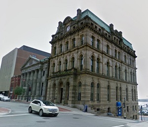
An image of Saint John, Canada:
Check out some more city maps in Canada:
Full list of Canada maps
This online map of Saint John (Canada) is provided by Bing Maps.
Please add a bookmark and share the page with your friends!