Thunder Bay is a city located in Northwestern Ontario, Canada. It stands on the shores of Lake Superior, the largest of the Great Lakes, and serves as a regional hub for commerce, transportation, and outdoor recreation. Thunder Bay is known for its natural beauty, rich Indigenous heritage, and diverse cultural scene. Today Thunder Bay is populated by 99 thousand inhabitants. This map shows the detailed scheme of Thunder Bay streets, including major sites and natural objecsts.
Zoom in or out, move the map's center by dragging your mouse or click the plus/minus buttons to zoom. Also check out a street view and a satellite map of Thunder Bay.
The exact coordinates of Thunder Bay, Canada for your GPS track:
Latitude 48.380993 North, Longitude 89.247726 West.
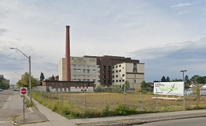
An image of Thunder Bay, Canada:
Check out some more city maps in Canada:
Full list of Canada maps
This online map of Thunder Bay (Canada) is provided by Bing Maps.
Please add a bookmark and share the page with your friends!