Trois-Rivières is a city located in the province of Quebec, Canada, at the confluence of the Saint-Maurice and Saint Lawrence rivers, halfway between Montreal and Quebec City. With a population of around 140 thousand, Trois-Rivières makes it into the top 10 in the province. This map shows the detailed scheme of Trois-Rivières streets, including major sites and natural objecsts.
Zoom in or out, move the map's center by dragging your mouse or click the plus/minus buttons to zoom. Also check out a street view and a satellite map of Trois-Rivières.
The exact coordinates of Trois-Rivières, Canada for your GPS track:
Latitude 46.34391 North, Longitude 72.543396 West.
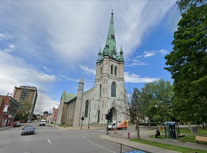
An image of Trois-Rivières, Canada:

Check out some more city maps in Canada:
Full list of Canada maps
This online map of Trois-Rivières (Canada) is provided by Bing Maps.
Please add a bookmark and share the page with your friends!

