Ghaziabad is a city in the Indian state of Uttar Pradesh, located in the National Capital Region (NCR) of Delhi. It is situated approximately 19 kilometers east of the capital city, New Delhi. Ghaziabad is one of the fastest-growing cities in the region and is known for its industrial and commercial significance. The population of Ghaziabad exceeds 1.6 million people. This map shows the detailed scheme of Ghaziabad streets, including major sites and natural objecsts.
Zoom in or out, move the map's center by dragging your mouse or click the plus/minus buttons to zoom.
Also check out the population, street view and a satellite map of Ghaziabad.
The exact coordinates of Ghaziabad, India for your GPS track:
Latitude 28.672112 North, Longitude 77.440292 East.
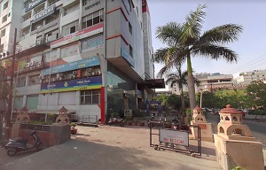
An image of Ghaziabad, India:
Check out some more city maps in India:
Full list of India maps
This online map of Ghaziabad (India) is provided by Bing Maps.
Please add a bookmark and share the page with your friends!