Tiruchirappalli, commonly known as Trichy, is a city located in the state of Tamil Nadu in southern India. It stands on the banks of the Kaveri River and is the fourth largest city in the state. Trichy has a rich historical and cultural heritage dating back several centuries. One of the most prominent landmarks in Trichy is the Rockfort Temple, situated atop a massive rock formation. Today Tiruchirappalli is populated by 847 thousand inhabitants. This map shows the detailed scheme of Tiruchirappalli streets, including major sites and natural objecsts.
Zoom in or out, move the map's center by dragging your mouse or click the plus/minus buttons to zoom.
Also check out the population, street view and a satellite map of Tiruchirappalli.
The exact coordinates of Tiruchirappalli, India for your GPS track:
Latitude 10.787494 North, Longitude 78.697891 East.
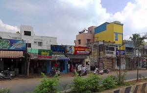
An image of Tiruchirappalli, India:
Check out some more city maps in India:
Full list of India maps
This online map of Tiruchirappalli (India) is provided by Bing Maps.
Please add a bookmark and share the page with your friends!