Kolkata, formerly known as Calcutta, is a major city located in the eastern part of India, in the state of West Bengal. It is the capital of West Bengal and serves as a cultural, commercial, and educational center in the region. Kolkata is known for its rich history, literary heritage, and vibrant arts scene. Now Kolkata is home to more than 4 million residents. This map shows the detailed scheme of Kolkata streets, including major sites and natural objecsts.
Zoom in or out, move the map's center by dragging your mouse or click the plus/minus buttons to zoom.
Also check out the population, street view and a satellite map of Kolkata.
The exact coordinates of Kolkata, India for your GPS track:
Latitude 22.582434 North, Longitude 88.361687 East.
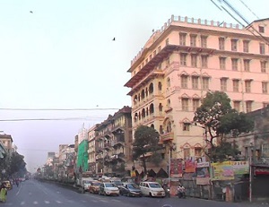
An image of Kolkata, India:
Check out some more city maps in India:
Full list of India maps
This online map of Kolkata (India) is provided by Bing Maps.
Please add a bookmark and share the page with your friends!