Vijayawada is a city located on the banks of the Krishna River in the state of Andhra Pradesh, India. It is the second-largest city in the state and serves as its commercial, political, and educational center. Known for its rich history, cultural heritage, and economic significance, Vijayawada is a bustling urban hub. Now Vijayawada is home to more than 1 million residents. This map shows the detailed scheme of Vijayawada streets, including major sites and natural objecsts.
Zoom in or out, move the map's center by dragging your mouse or click the plus/minus buttons to zoom.
Also check out the population, street view and a satellite map of Vijayawada.
The exact coordinates of Vijayawada, India for your GPS track:
Latitude 16.511333 North, Longitude 80.617821 East.
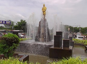
An image of Vijayawada, India:
Check out some more city maps in India:
Full list of India maps
This online map of Vijayawada (India) is provided by Bing Maps.
Please add a bookmark and share the page with your friends!