The exact coordinates of Lanett Alabama for your GPS track:
Latitude 32.868042 North, Longitude 85.192612 West.
Please share the link with friends and neighbors:
Share on Facebook
Share on WhatsApp
Share on Telegram
Share on Facebook
Share on WhatsApp
Share on Telegram
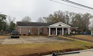
An image of Lanett
More city maps of Alabama:
- Map of Huntsville
Huntsville is a city located in Madison County in the Appalachian region of northern Alabama.... - Map of Tuscaloosa
Tuscaloosa is the fifth-largest city in Alabama with population of some 95 thousand people. Tuscal... - Map of Dothan
Dothan, Alabama is a small city located on the border between Alabama and Florida. The population ... - Map of Gadsden
Gadsden, Alabama (incorporated in 1867) is the county seat of Etowah County. The population of Gad... - Map of Homewood
Homewood, Alabama is a charming city found in Jefferson County. The population of Homewood exceeds... - Map of Oxford
Oxford, Alabama is a lovely city located mainly in Calhoun County. Incorporated, in 1852, today Ox... - Map of Cullman
Cullman is a city located in Cullman County, Alabama. It stands about 50 miles north of Birmingham... - Map of Calera
Calera, Alabama is a city located in Shelby County. It stands about 30 miles south of Birmingham a... - Map of Scottsboro
Scottsboro, Alabama is a city in Jackson County. It is situated in the northeastern part of the st... - Map of Chelsea
Chelsea, Alabama is a lovely city located in Shelby County. It stands in the central part of the s... - Map of Moody
Moody, Alabama is a shining city located in St. Clair County, about 20 miles east of Birmingham. M... - Map of Leeds
Leeds, Alabama is a city located in Jefferson and St. Clair Counties. It stands in the central par... - Map of Fairfield
Fairfield, Alabama is a wonderful city located in Jefferson County, in the central part of the sta... - Map of Meadowbrook
Meadowbrook, Alabama is a wonderful unincorporated community in Shelby County. It's located south ... - Map of Clanton
Clanton is an adorable city located in the central part of Alabama. It is the county seat of Chilt... - Map of Orange Beach
Orange Beach is a city located in Baldwin County, Alabama. It stands along the Gulf of Mexico in t... - Map of Montevallo
Montevallo, Alabama is a lovely city located in Shelby County. It is known for its historic charm,...
Full list of Alabama maps
This online map of Lanett, Alabama is provided by Bing Maps. Please add a bookmark and share the page with your friends!