The exact coordinates of Semmes Alabama for your GPS track:
Latitude 30.779045 North, Longitude 88.2584 West.
Please share the link with friends and neighbors:
Share on Facebook
Share on WhatsApp
Share on Telegram
Share on Facebook
Share on WhatsApp
Share on Telegram
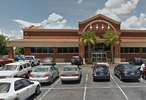
An image of Semmes
More city maps of Alabama:
- Map of Birmingham
Birmingham is a city located in the north-central region of the state of Alabama, in the United St... - Map of Montgomery
Montgomery is the Capital city of Alabama with population of over 200 thousand people. Today, Mont... - Map of Mobile
Mobile is the county seat of Mobile County, Alabama, United States. The city is located on the cen... - Map of Hoover
Hoover, Alabama is a southern suburb of Birmingham. The population of Hoover is over 85 thousand p... - Map of Auburn
Auburn, Alabama, is a city in the eastern part of the state with 63 thousand inhabitants. Auburn, ... - Map of Florence
Florence, incorporated in 1826, is a city Alabama and a county seat for Lauderdale County. The cit... - Map of Prattville
Prattville, Alabama is a nice city located 12 miles northwest to Montgomery. Founded back in 1839,... - Map of Trussville
Trussville, Alabama is a lovely city located about 15 miles northeast of Birmingham. Incorporated ... - Map of Albertville
Albertville, Alabama is a wonderful city situated in Marshall County. Incorporated on February 18,... - Map of Anniston
Anniston, Alabama is a pleasant city and the county seat of Calhoun County. The population of Anni... - Map of Tillmans Corner
Tillmans Corner is an unincorporated community located in Mobile County, Alabama. It is situated i... - Map of Center Point
Center Point is a city located in Jefferson County, Alabama. It stands about 12 miles northeast of... - Map of Talladega
Talladega, Alabama is a charming city located in Talladega County. It stands in the central part o... - Map of Gulf Shores
Gulf Shores, Alabama is a wonderful coastal city situated in Baldwin County, along the Gulf of Mex... - Map of McCalla
McCalla is an unincorporated community located in Jefferson County, Alabama. It is situated in the... - Map of Sylacauga
Sylacauga, Alabama is a charming city located in Talladega County, in the eastern part of the stat... - Map of Clay
Clay, Alabama is a small city located in Jefferson County. It stands in the central part of the st...
Full list of Alabama maps
This online map of Semmes, Alabama is provided by Bing Maps. Please add a bookmark and share the page with your friends!