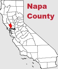
The borders of Napa County over the map of California
Explore some more counties of California:
- Yuba County
- Yolo County
- Tuolumne County
- Tulare County
- Trinity County
- Tehama County
- Sutter County
- Stanislaus County
- Sonoma County
- Solano County
- Siskiyou County
- Sierra County
- Shasta County
- Santa Cruz County
- Santa Barbara County
- San Mateo County
- San Luis Obispo County
- San Benito County
- Plumas County
- Placer County
Full list of California maps
This online map of Napa County, California is provided by Bing Maps. Please add a bookmark and share the page with your friends!