San Bernardino County on the map of California 2026. Cities, roads, borders and directions in San Bernardino County of California.
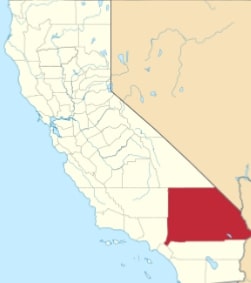
USA / California / San Bernardino CountySan Bernardino County is the largest county in mainland US by area. The county spans over 20,105 square miles and includes some large cities. The official site of San Bernardino County is www.sbcounty.gov. The county seat is the city of San Bernardino. This map shows the borders of San Bernardino County as well as neighboring counties, including major highways and natural objecsts as of 2026. Zoom in or out of the map using the plus/minus panel. Move the center of this map by dragging it. Also check out the satellite map of San Bernardino County.
The borders of San Bernardino County over the map of California
Explore some more counties of California:
- Yuba County
- Yolo County
- Tuolumne County
- Tulare County
- Trinity County
- Tehama County
- Sutter County
- Stanislaus County
- Sonoma County
- Solano County
- Siskiyou County
- Sierra County
- Shasta County
- Santa Cruz County
- Santa Barbara County
- San Mateo County
- San Luis Obispo County
- San Benito County
- Plumas County
- Placer County
Full list of California maps
This online map of San Bernardino County, California is provided by Bing Maps. Please add a bookmark and share the page with your friends!
© 2026 City maps and famous places