The exact coordinates of Lamar Colorado for your GPS track:
Latitude 38.0882 North, Longitude 102.619308 West.
ZIP codes for Lamar:
81052
Please share the link with friends and neighbors:
Share on Facebook
Share on WhatsApp
Share on Telegram
Share on Facebook
Share on WhatsApp
Share on Telegram
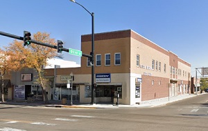
An image of Lamar
More city maps of Colorado:
- Map of Colorado Springs
Colorado Springs is an awesome city located in the central part of Colorado, at the base of the Ro... - Map of Denver
Denver is the capital city of Colorado state. It's sometimes called Mile-High City because its ele... - Map of Centennial
Centennial, Colorado (incorporated 2001) is a young and fast growing city located on the southern ... - Map of Loveland
Loveland, Colorado is a part of Fort Collins-Loveland conurbation. The population of Loveland is o... - Map of Castle Rock
Castle Rock, Colorado is a town, incorporated in 1881, that is located 20 miles south to downtown ... - Map of Littleton
Littleton, Colorado is a southern suburb of Denver with 45 thousand residents. It is a home rule m... - Map of Security-Widefield
Security-Widefield, Colorado is a nice suburban CDP of Colorado Springs, located in El Paso County... - Map of Pueblo West
Pueblo West, Colorado is a CDP situated about 42 miles south of Colorado Springs, in Pueblo County... - Map of Louisville
Louisville, Colorado is a charming city found 22 miles north of Denver, in Boulder County. The pop... - Map of Cañon City
Cañon City, Colorado is a charming city located in Fremont County. It stands in the central part ... - Map of Greenwood Village
Greenwood Village, Colorado is a suburban city located in Arapahoe County. It is a part of the Den... - Map of Lone Tree
Lone Tree, Colorado is an adorable suburban city located in Douglas County. It is part of the Denv... - Map of Cherry Creek
Cherry Creek is a CDP located near Denver, in Arapahoe County, Colorado. The population of Cherry ... - Map of Rifle
Rifle, Colorado is a city located in Garfield County. It is situated in the western part of the st... - Map of Fairmount
Fairmount, Colorado is an unincorporated community located in Jefferson County. It is situated clo... - Map of The Pinery
The Pinery is a residential community located in Douglas County, Colorado. It is a suburban area s... - Map of Evergreen
Evergreen, Colorado is an adorable picturesque mountain town located in Jefferson County. It is ne...
This online map of Lamar, Colorado is provided by Bing Maps. Please add a bookmark and share the page with your friends!