The exact coordinates of Todd Creek Colorado for your GPS track:
Latitude 39.97562 North, Longitude 104.868896 West.
Please share the link with friends and neighbors:
Share on Facebook
Share on WhatsApp
Share on Telegram
Share on Facebook
Share on WhatsApp
Share on Telegram
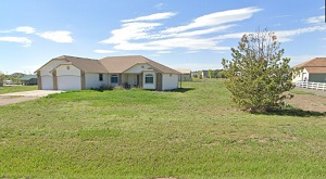
An image of Todd Creek
More city maps of Colorado:
- Map of Parker
Parker, Colorado is a town in Douglas County with 58 thousand residents. It is a home rule municip... - Map of Englewood
Englewood, Colorado is a suburban city of Denver, found in Arapahoe County. The population of Engl... - Map of Dakota Ridge
Dakota Ridge, Colorado is a nice suburb of Denver, located in Jefferson County. Dakota Ridge is ho... - Map of Four Square Mile
Four Square Mile, Colorado is a lovely CDP located near Aurora, in Arapahoe County. Today Four Squ... - Map of Cimarron Hills
Cimarron Hills, Colorado is a census-designated place (CDP) located in El Paso County. It is part ... - Map of Firestone
Firestone, Colorado is a shining town located in Weld County. It is part of the Denver Metropolita... - Map of Sterling
Sterling, Colorado is a pleasant city located in Logan County, in the northeastern part of the sta... - Map of Fort Morgan
Fort Morgan, Colorado is a lovely city located in Morgan County. It is situated on the eastern pla... - Map of Edwards
Edwards, Colorado is an unincorporated community located in Eagle County. It is situated in the Va... - Map of Glenwood Springs
Glenwood Springs, Colorado is a city located in Garfield County. It is situated in the Rocky Mount... - Map of Severance
Severance is a beautiful town located in Weld County, in northern Colorado, approximately 60 miles... - Map of Timnath
Timnath is a shining town located in Larimer County, in northern Colorado, approximately 50 miles ... - Map of Derby
Derby, Colorado is a wonderful CDP found in Adams County. It is a suburban community located about... - Map of Fort Lupton
Fort Lupton, Colorado is a city located in Weld County, about 30 miles northeast of Denver, the st... - Map of Fruitvale
Fruitvale, Colorado is an adorable community and a census-designated place in Mesa County. It is s... - Map of Aspen
Aspen, Colorado is a shining town in Pitkin County. It is a world-renowned resort located in the c... - Map of Twin Lakes
Twin Lakes, Colorado is a beautiful CDP located in Adams County. It is a part of the Denver-Aurora...
Full list of Colorado maps
This online map of Todd Creek, Colorado is provided by Bing Maps. Please add a bookmark and share the page with your friends!