The exact coordinates of Trinidad Colorado for your GPS track:
Latitude 37.170795 North, Longitude 104.506691 West.
Please share the link with friends and neighbors:
Share on Facebook
Share on WhatsApp
Share on Telegram
Share on Facebook
Share on WhatsApp
Share on Telegram
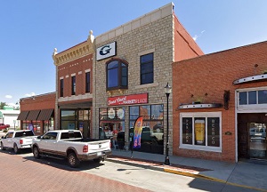
An image of Trinidad
More city maps of Colorado:
- Map of Colorado Springs
Colorado Springs is a city located in the central part of the state of Colorado, in the United Sta... - Map of Denver
Denver is the capital city of Colorado state. It's sometimes called Mile-High City because its ele... - Map of Centennial
Centennial, Colorado (incorporated 2001) is a young and fast growing city located on the southern ... - Map of Loveland
Loveland, Colorado is a part of Fort Collins-Loveland conurbation. The population of Loveland is o... - Map of Castle Rock
Castle Rock, Colorado is a town, incorporated in 1881, that is located 20 miles south to downtown ... - Map of Littleton
Littleton, Colorado is a southern suburb of Denver with 45 thousand residents. It is a home rule m... - Map of Security-Widefield
Security-Widefield, Colorado is a nice suburban CDP of Colorado Springs, located in El Paso County... - Map of Pueblo West
Pueblo West, Colorado is a CDP situated about 42 miles south of Colorado Springs, in Pueblo County... - Map of Louisville
Louisville, Colorado is a charming city found 22 miles north of Denver, in Boulder County. The pop... - Map of Cañon City
Cañon City, Colorado is a charming city located in Fremont County. It stands in the central part ... - Map of Greenwood Village
Greenwood Village, Colorado is a suburban city located in Arapahoe County. It is a part of the Den... - Map of Lone Tree
Lone Tree, Colorado is an adorable suburban city located in Douglas County. It is part of the Denv... - Map of Cherry Creek
Cherry Creek is a CDP located near Denver, in Arapahoe County, Colorado. The population of Cherry ... - Map of Rifle
Rifle, Colorado is a dynamic city located in Garfield County. It is situated in the western part o... - Map of Fairmount
Fairmount, Colorado is an unincorporated community located in Jefferson County. It is situated nea... - Map of The Pinery
The Pinery is a residential community located in Douglas County, Colorado. It is a suburban area s... - Map of Evergreen
Evergreen, Colorado is an adorable picturesque mountain town located in Jefferson County. It is ne...
Distances from Trinidad, Colorado:
- Distance between Trinidad and Colorado Springs
- Distance between Trinidad and Denver
- Distance between Trinidad and Centennial
- Distance between Trinidad and Loveland
- Distance between Trinidad and Castle Rock
- Distance between Trinidad and Littleton
- Distance between Trinidad and Security-Widefield
- Distance between Trinidad and Pueblo West
- Distance between Trinidad and Louisville
- Distance between Trinidad and Cañon City
- Distance between Trinidad and Greenwood Village
- Distance between Trinidad and Lone Tree
- Distance between Trinidad and Cherry Creek
- Distance between Trinidad and Rifle
- Distance between Trinidad and Fairmount
- Distance between Trinidad and The Pinery
- Distance between Trinidad and Evergreen
Full list of Colorado maps
This online map of Trinidad, Colorado is provided by Bing Maps. Please add a bookmark and share the page with your friends!