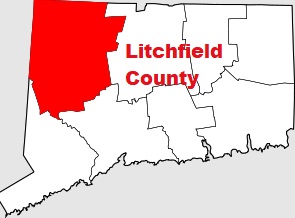
Litchfield County is a vast county situated in the northwestern corner of Connecticut. This well known county was established as early as 1751. This is the only county in Connecticutthat has no specific county seat. The population of Litchfield County is about 185 thousand inhabitants. The total area of the county is 920 square miles. This map shows the borders of Litchfield County as well as neighboring counties,
including major highways and natural objecsts as of 2024.
Zoom in or out of the map using the plus/minus panel. Move the center of this map by dragging it.
Also check out the satellite map of Litchfield County.
Please share the map of Litchfield County with your friends:
The borders of Litchfield County over the map of Connecticut
Explore some more counties of Connecticut:
This online map of Litchfield County, Connecticut is provided by Bing Maps.
Please add a bookmark and share the page with your friends!