The exact coordinates of Georgetown Delaware for your GPS track:
Latitude 38.690342 North, Longitude 75.385986 West.
Please share the link with friends and neighbors:
Share on Facebook
Share on WhatsApp
Share on Telegram
Share on Facebook
Share on WhatsApp
Share on Telegram
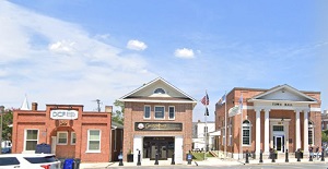
An image of Georgetown
More city maps of Delaware:
- Map of Middletown
Middletown is the 4th largest municipality in Delaware with 22 thousand residents. This beautiful ... - Map of Glasgow
Glasgow, Delaware is an unincorporated community and census-designated place (CDP) located in New ... - Map of Milford
Milford, Delaware is a shining city located in Kent County. It is situated in central Delaware, ne... - Map of New Castle
New Castle, Delaware is the county seat of New Castle County. The city is situated in the northern...
Full list of Delaware maps
This online map of Georgetown, Delaware is provided by Bing Maps. Please add a bookmark and share the page with your friends!