The exact coordinates of Longboat Key Florida for your GPS track:
Latitude 27.413168 North, Longitude 82.659813 West.
Please share the link with friends and neighbors:
Share on Facebook
Share on WhatsApp
Share on Telegram
Share on Facebook
Share on WhatsApp
Share on Telegram
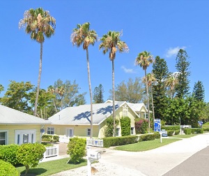
An image of Longboat Key
More city maps of Florida:
- Map of St. Petersburg
St. Petersburg is a big city on Tampa Bay coast in western Florida with a population of 245 thousa... - Map of Fort Lauderdale
Fort Lauderdale is a city in Broward County, Florida, United States. It is known as the "Venice of... - Map of Plantation
Plantation, Florida (incorporated in 1953) is a resort city located near Fort Lauderdale. The popu... - Map of Miami Beach
Miami Beach, incorporated 1915, is a popular resort city located on a group of islands to the east... - Map of Riverview
Riverview Florida is a large CDP in the southeastern part of Tampa Bay area. Riverview is located ... - Map of Surfside
Surfside, Florida is a small coastal town in Miami-Dade county. Its population exceeds 5000 reside... - Map of Fort Myers
Fort Myers is a city in the southern part of Florida with some 86 thousand residents. It is the co... - Map of Homestead
Homestead, Florida is a large southern suburb of Miami located in Miami-Dade County. The populatio... - Map of The Villages
The Villages, Florida is a remarkable CDP located in Sumter County, about 55 miles southwest to Or... - Map of Delray Beach
Delray Beach, Florida is a nice coastal city situated near Boca Raton in Palm Beach County. Delray... - Map of Jupiter
Jupiter, Florida is a wonderful city situated in Palm Beach County. Jupiter is home to 65 thousand... - Map of North Miami
North Miami, Florida is a remarkable coastal city located in Miami-Dade County, about 9 miles nort... - Map of Sanford
The city of Sanford, Florida is the county seat of Seminole County. Sanford is located about 27 mi... - Map of Bonita Springs
Bonita Springs is an astonishing coastal city located in Lee County of Florida. Bonita Springs is ... - Map of Westchester
Westchester, Florida is a remarkable CDP located in Miami-Dade County, about 12 miles west to Miam... - Map of Country Club
Country Club, Florida is a nice CDP situated in Miami-Dade County, about 20 miles northwest to Mia... - Map of Four Corners
Four Corners AKA Citrus Ridge is an excellent CDP located in Lake County of Florida, about 25 mile...
Full list of Florida maps
This online map of Longboat Key, Florida is provided by Bing Maps. Please add a bookmark and share the page with your friends!