Linn County on the map of Iowa 2026. Cities, roads, borders and directions in Linn County of Iowa.
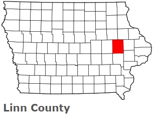
USA / Iowa / Linn CountyLinn County is situated in the eastern part of Iowa. This hilarious county is named after Lewis Fields Linn, doctor and Missouri Senator. The total area of Linn County is about 718 square miles. This county, set up on Dec 21, 1837, is populated today by at least 229 thousand residents. Cedar Rapids is the county seat of Linn County. This map shows the borders of Linn County as well as neighboring counties, including major highways and natural objecsts as of 2026. Zoom in or out of the map using the plus/minus panel. Move the center of this map by dragging it. Also check out the satellite map of Linn County.
The borders of Linn County over the map of Iowa
Explore some more counties of Iowa:
- O'Brien County
- Wright County
- Worth County
- Woodbury County
- Winneshiek County
- Winnebago County
- Webster County
- Wayne County
- Washington County
- Warren County
- Wapello County
- Van Buren County
- Union County
- Taylor County
- Tama County
- Story County
- Sioux County
- Shelby County
- Scott County
- Sac County
Full list of Iowa maps
This online map of Linn County, Iowa is provided by Bing Maps. Please add a bookmark and share the page with your friends!
© 2026 City maps and famous places