Power County on the map of Idaho 2025. Cities, roads, borders and directions in Power County of Idaho.
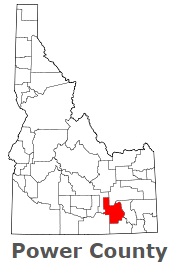
USA / Idaho / Power CountyPower County is located in the southern lands of Idaho. This exciting county is named after the American Falls Power Plant. The county seat of Power County is American Falls. The county's area is about 1406 square miles. Established in 1913, today Power County is home to 8 thousand residents. This map shows the borders of Power County as well as neighboring counties, including major highways and natural objecsts as of 2025. Zoom in or out of the map using the plus/minus panel. Move the center of this map by dragging it. Also check out the satellite map of Power County.
The borders of Power County over the map of Idaho
Explore some more counties of Idaho:
- Washington County
- Valley County
- Twin Falls County
- Teton County
- Shoshone County
- Payette County
- Owyhee County
- Oneida County
- Nez Perce County
- Minidoka County
- Madison County
- Lincoln County
- Lewis County
- Lemhi County
- Latah County
- Kootenai County
- Jerome County
- Jefferson County
- Idaho County
- Gooding County
Full list of Idaho maps
This online map of Power County, Idaho is provided by Bing Maps. Please add a bookmark and share the page with your friends!
© 2025 City maps and famous places