The exact coordinates of Eureka Illinois for your GPS track:
Latitude 40.721172 North, Longitude 89.272949 West.
Please share the link with friends and neighbors:
Share on Facebook
Share on WhatsApp
Share on Telegram
Share on Facebook
Share on WhatsApp
Share on Telegram
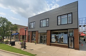
An image of Eureka
More city maps of Illinois:
- Map of Rockford
Rockford is a city on the northern edge of Illinois, standing on the banks of Rock River. Its popu... - Map of Cicero
Cicero, Illinois is a large western suburb of Chicago with 80 thousand residents. The town was inc... - Map of Skokie
Skokie, Illinois is an amazing village located in Cook County, about 13 miles north to Chicago. Sk... - Map of Berwyn
Berwyn, Illinois is a suburban city of Chicago situated in Cook County, only 10 miles west to the ... - Map of Wheaton
Wheaton, Illinois is a cool city located 25 miles west to downtown Chicago, in DuPage County. Whea... - Map of Downers Grove
Downers Grove, Illinois is a superb village located about 20 miles west to Chicago, in DuPage Coun... - Map of Buffalo Grove
The Village of Buffalo Grove, Illinois is situated about 35 miles northwest to downtown Chicago. B... - Map of Romeoville
Romeoville, Illinois is an impressive village located in Will County. The approximate population ... - Map of Urbana
The city of Urbana, Illinois is the county seat of Champaign County. Today Urbana is home to 39 th... - Map of Rock Island
Rock Island, Illinois is a superb city functioning as the county seat of Rock Island County. Rock ... - Map of Woodridge
Woodridge, Illinois is a breathtaking village situated near Naperville, in DuPage County. Woodridg... - Map of Mundelein
Mundelein, Illinois is a beautiful village located 40 miles northwest to Chicago, in Lake County. ... - Map of Algonquin
Algonquin, Illinois is a beautiful village located about 46 miles northwest to Chicago, in McHenry... - Map of Glen Ellyn
Glen Ellyn, Illinois is a nice village situated in DuPage County, about 24 miles west to downtown ... - Map of McHenry
McHenry, Illinois (founded in 1836) is a charming city standing 53 miles northwest of downtown Chi... - Map of Lockport
Lockport, Illinois is a wonderful city situated in Will County. Founded in 1853, today Lockport is... - Map of Edwardsville
Edwardsville, Illinois is a beautiful city located 23 miles northeast of St. Louis. It is the coun...
Full list of Illinois maps
This online map of Eureka, Illinois is provided by Bing Maps. Please add a bookmark and share the page with your friends!