The exact coordinates of Monticello Indiana for your GPS track:
Latitude 40.746078 North, Longitude 86.762878 West.
Please share the link with friends and neighbors:
Share on Facebook
Share on WhatsApp
Share on Telegram
Share on Facebook
Share on WhatsApp
Share on Telegram
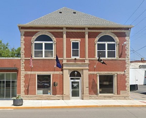
An image of Monticello
More city maps of Indiana:
- Map of Bloomington
Bloomington is a city in southern Indiana with a population of some 80 thousand people. Bloomingto... - Map of Indianapolis
Indianapolis is the capital and largest city of the state of Indiana.... - Map of Muncie
Muncie, Indiana is a city in Delaware County with 65 thousand residents. Incorporated in 1865 as a... - Map of Terre Haute
Terre Haute, Indiana is the county seat of Vigo County. Terre Haute is populated these days by 59 ... - Map of Columbus
Columbus, Indiana is the county seat of Bartholomew County. The approximate population of Columbus... - Map of New Albany
New Albany, Indiana is a nice suburban city of Louisville, KY, located in Floyd County. New Alban... - Map of Valparaiso
The city of Valparaiso, Indiana is the county seat of Porter County. Incorporated on July 8, 1836,... - Map of Hobart
Hobart is a city in Lake County, Indiana, United States. It is located in the Chicago metropolitan... - Map of Munster
Munster is a town in North Township, Lake County, Indiana, United States. It is located in the Chi... - Map of St. John
St. John is a town located in Lake County, Indiana, United States. It is a suburb of Chicago and i... - Map of New Castle
New Castle is a city located in the east-central part of Indiana, in Henry County. The city has a ... - Map of Crawfordsville
Crawfordsville is a city located in Montgomery County, in the west-central part of Indiana. The ci... - Map of Warsaw
Warsaw is a city located in the northern part of Indiana, in Kosciusko County. The city has a popu... - Map of Speedway
Speedway, Indiana is a town located in Marion County, just northwest of Indianapolis. Speedway is ... - Map of Washington
Washington is a city located in the southwestern part of the state of Indiana. It is the county se... - Map of Lowell
Lowell, Indiana is a town located in Lake County, approximately 45 miles southeast of Chicago, Ill... - Map of Bargersville
Bargersville is a town located in White River Township, Johnson County, Indiana. It stands in cent...
Full list of Indiana maps
This online map of Monticello, Indiana is provided by Bing Maps. Please add a bookmark and share the page with your friends!