The exact coordinates of Dodge City Kansas for your GPS track:
Latitude 37.753281 North, Longitude 100.016785 West.
Please share the link with friends and neighbors:
Share on Facebook
Share on WhatsApp
Share on Telegram
Share on Facebook
Share on WhatsApp
Share on Telegram
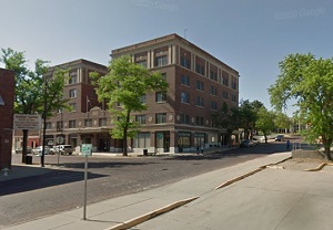
An image of Dodge City
More city maps of Kansas:
- Map of Junction City
Junction City, Kansas is a dynamic city and the county seat of Geary County. It is located in the ... - Map of McPherson
McPherson, Kansas is a charming city in McPherson County. It is situated in the central part of th... - Map of Lansing
Lansing, Kansas is a lovely city located in Leavenworth County, approximately 20 miles northwest o... - Map of Parsons
Parsons, Kansas is a beautiful city located in Labette County. It is situated in southeastern Kans... - Map of Park City
Park City is a city located in Sedgwick County, in south-central Kansas, just to the north of Wich... - Map of Wellington
Wellington, Kansas is a wonderful city that serves as the county seat of Sumner County. It stands ... - Map of Mulvane
Mulvane, Kansas is a city found in Sedgwick and Sumner counties in south-central Kansas. One of th... - Map of Maize
Maize is a city located in Sedgwick County, in the south-central part of Kansas, near the city of ... - Map of Colby
Colby is a lovely city situated in northwestern Kansas, about 370 miles west of Kansas City. It is...
Distances from Dodge City, Kansas:
- Distance between Dodge City and Junction City
- Distance between Dodge City and McPherson
- Distance between Dodge City and Lansing
- Distance between Dodge City and Parsons
- Distance between Dodge City and Park City
- Distance between Dodge City and Wellington
- Distance between Dodge City and Mulvane
- Distance between Dodge City and Maize
- Distance between Dodge City and Colby
Full list of Kansas maps
This online map of Dodge City, Kansas is provided by Bing Maps. Please add a bookmark and share the page with your friends!