The exact coordinates of Maize Kansas for your GPS track:
Latitude 37.780804 North, Longitude 97.4636 West.
Please share the link with friends and neighbors:
Share on Facebook
Share on WhatsApp
Share on Telegram
Share on Facebook
Share on WhatsApp
Share on Telegram
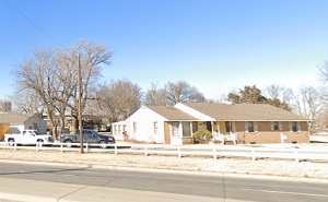
An image of Maize
More city maps of Kansas:
- Map of Dodge City
Dodge City is the county seat of Ford County and is known for its rich history as a center of the ... - Map of Junction City
Junction City, Kansas is a dynamic city and the county seat of Geary County. It is located in the ... - Map of McPherson
McPherson, Kansas is a charming city in McPherson County. It is situated in the central part of th... - Map of Lansing
Lansing, Kansas is a lovely city located in Leavenworth County, approximately 20 miles northwest o... - Map of Parsons
Parsons, Kansas is a beautiful city located in Labette County. It is situated in southeastern Kans... - Map of Park City
Park City is a city located in Sedgwick County, in south-central Kansas, just to the north of Wich... - Map of Wellington
Wellington, Kansas is a wonderful city that serves as the county seat of Sumner County. It stands ... - Map of Mulvane
Mulvane, Kansas is a city found in Sedgwick and Sumner counties in south-central Kansas. One of th... - Map of Colby
Colby is a lovely city situated in northwestern Kansas, about 370 miles west of Kansas City. It is...
Full list of Kansas maps
This online map of Maize, Kansas is provided by Bing Maps. Please add a bookmark and share the page with your friends!