The exact coordinates of Olathe Kansas for your GPS track:
Latitude 38.883041 North, Longitude 94.819138 West.
Please share the link with friends and neighbors:
Share on Facebook
Share on WhatsApp
Share on Telegram
Share on Facebook
Share on WhatsApp
Share on Telegram
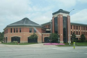
An image of Olathe
More city maps of Kansas:
- Map of Wichita
Wichita is the largest city in the state of Kansas and the county seat of Sedgwick County. Its pop... - Map of Leawood
Leawood, Kansas is a suburb of Kansas City, situated in Johnson County. Today Leawood is populated... - Map of Gardner
Gardner is a city located in Johnson County, Kansas, United States. It is a suburb of Kansas City ... - Map of Andover
Andover, Kansas is a wonderful city situated in Butler County. It stands in the south-central part... - Map of Arkansas City
Arkansas City is located in Cowley County, Kansas. It stands in the southern part of the state, ne... - Map of Atchison
Atchison, Kansas is an adorable city and the county seat of Atchison County. Atchison is located i... - Map of Bel Aire
Bel Aire, Kansas is a lovely city located in Sedgwick County. It is situated in south-central Kans... - Map of Fort Riley
Fort Riley is a United States Army installation located in the Flint Hills region of Kansas, near ... - Map of Valley Center
Valley Center is a city located in Sedgwick County, in south-central Kansas, about 10 miles north ... - Map of Abilene
Abilene is a charming city found in central Kansas, and it is the county seat of Dickinson County.... - Map of Ulysses
Ulysses, Kansas is a city that serves as the county seat of Grant County. It is located in the sou... - Map of Concordia
Concordia is a city situated in the central part of Kansas. It serves as the county seat of Cloud ...
Distances from Olathe, Kansas:
- Distance between Olathe and Wichita
- Distance between Olathe and Leawood
- Distance between Olathe and Gardner
- Distance between Olathe and Andover
- Distance between Olathe and Arkansas City
- Distance between Olathe and Atchison
- Distance between Olathe and Bel Aire
- Distance between Olathe and Fort Riley
- Distance between Olathe and Valley Center
- Distance between Olathe and Abilene
- Distance between Olathe and Ulysses
- Distance between Olathe and Concordia
Full list of Kansas maps
This online map of Olathe, Kansas is provided by Bing Maps. Please add a bookmark and share the page with your friends!