Lafourche Parish on the map of Louisiana 2026. Cities, roads, borders and directions in Lafourche Parish of Louisiana.
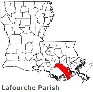
USA / Louisiana / Lafourche ParishLafourche Parish is situated in the southeastern coastal part of Louisiana. This particular parish is named after a French word la fourche (the fork). The total area of Lafourche Parish is about 1472 square miles. This parish, set up in 1807, is populated today by at least 98 thousand residents. Thibodaux is the parish seat of Lafourche Parish. This map shows the borders of Lafourche Parish as well as neighboring counties, including major highways and natural objecsts as of 2026. Zoom in or out of the map using the plus/minus panel. Move the center of this map by dragging it. Also check out the satellite map of Lafourche Parish.
The borders of Lafourche Parish over the map of Louisiana
Explore some more counties of Louisiana:
- Winn Parish
- West Feliciana Parish
- West Carroll Parish
- West Baton Rouge Parish
- Webster Parish
- Washington Parish
- Vernon Parish
- Vermilion Parish
- Union Parish
- Terrebonne Parish
- Tensas Parish
- Tangipahoa Parish
- St. Tammany Parish
- St. Mary Parish
- St. Martin Parish
- St. Landry Parish
- St. John the Baptist Parish
- St. James Parish
- St. Helena Parish
- St. Charles Parish
Full list of Louisiana maps
This online map of Lafourche Parish, Louisiana is provided by Bing Maps. Please add a bookmark and share the page with your friends!
© 2026 City maps and famous places