Gratiot County on the map of Michigan 2026. Cities, roads, borders and directions in Gratiot County of Michigan.
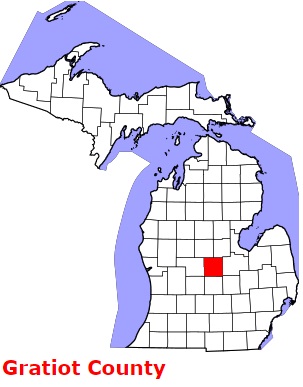
USA / Michigan / Gratiot CountyGratiot County is found at the very center of Michigan. The population of Gratiot County exceeds 42 thousand people. The county, formed back in 1831 from unorganized territory, spans a total area of 572 square miles. The county seat of Gratiot County is Ithaca. The county is named after Captain Charles Gratiot (1788-1855), who built Fort Gratiot at the present site of Port Huron. This map shows the borders of Gratiot County as well as neighboring counties, including major highways and natural objecsts as of 2026. Zoom in or out of the map using the plus/minus panel. Move the center of this map by dragging it. Also check out the satellite map of Gratiot County.
The borders of Gratiot County over the map of Michigan
Explore some more counties of Michigan:
- Wexford County
- Washtenaw County
- Van Buren County
- Tuscola County
- Shiawassee County
- Schoolcraft County
- Sanilac County
- St. Joseph County
- St. Clair County
- Saginaw County
- Roscommon County
- Presque Isle County
- Ottawa County
- Otsego County
- Oscoda County
- Osceola County
- Ontonagon County
- Ogemaw County
- Oceana County
- Newaygo County
Full list of Michigan maps
This online map of Gratiot County, Michigan is provided by Bing Maps. Please add a bookmark and share the page with your friends!
© 2026 City maps and famous places