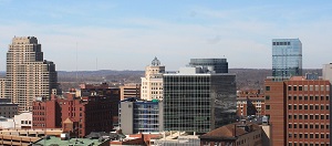
 Michigan is a Midwestern state in the Great Lakes area. Lansing is the capital city and Detroit is the largest one. The population of Michigan is 10M. These interactive maps contain detailed schemes of Michigan cities, including major sites and natural objecsts.
The cities are sorted alphabetically. You can search the maps to find any street or house. Click on the city name to view its detailed map.
Michigan is a Midwestern state in the Great Lakes area. Lansing is the capital city and Detroit is the largest one. The population of Michigan is 10M. These interactive maps contain detailed schemes of Michigan cities, including major sites and natural objecsts.
The cities are sorted alphabetically. You can search the maps to find any street or house. Click on the city name to view its detailed map.
- Ada
- Adrian
- Algoma Township
- Allen Park
- Allendale
- Alpena
- Alpine
- Ann Arbor
- Antwerp Township
- Auburn Hills
- Bangor Charter Township
- Bath Charter Township
- Battle Creek
- Bay City
- Bedford Township
- Benton Charter Township
- Berkley
- Birmingham
- Blackman
- Bloomfield Township
- Brandon Township
- Bridgeport Charter Township
- Brighton Township
- Brownstown
- Burton
- Byron Township
- Cadillac
- Caledonia Township
- Cannon Township
- Canton
- Cascade Charter Township
- Chesterfield
- Clawson
- Clinton
- Coldwater
- Commerce
- Comstock Township
- Cooper Charter Township
- Davison Township
- Dearborn
- Dearborn Heights
- Delhi Charter Township
- Delta
- Detroit
- DeWitt Charter Township
- East Bay Charter Township
- East Grand Rapids
- East Lansing
- Eastpointe
- Egelston Township
- Emmett Charter Township
- Escanaba
- Farmington
- Farmington Hills
- Fenton
- Fenton Charter Township
- Ferndale
- Flat Rock
- Flint
- Flushing Charter Township
- Fort Gratiot Township
- Fraser
- Frenchtown
- Fruitport Charter Township
- Gaines Township
- Garden City
- Garfield Charter Township
- Genesee
- Genoa Township
- Georgetown Township
- Grand Blanc
- Grand Haven
- Grand Haven Charter Township
- Grand Rapids
- Grand Rapids Charter Township
- Grandville
- Green Oak
- Grosse Ile
- Grosse Pointe Farms
- Grosse Pointe Park
- Grosse Pointe Woods
- Hamburg
- Hamtramck
- Harper Woods
- Harrison Township
- Hartland
- Hazel Park
- Highland Township
- Holland
- Holland Charter Township
- Holly
- Howell
- Huron Charter Township
- Independence Township
- Inkster
- Ionia
- Jackson
- Kalamazoo
- Kentwood
- Lansing
- Lenox Township
- Leoni
- Lincoln Charter Township
- Lincoln Park
- Livonia
- Lyon Township
- Macomb
- Madison Heights
- Marion Township
- Marquette
- Melvindale
- Meridian
- Midland
- Milford Charter Township
- Monitor Charter Township
- Monroe
- Monroe Charter Township
- Mount Clemens
- Mount Morris Township
- Mount Pleasant
- Mundy Township
- Muskegon
- Muskegon Charter Township
- Muskegon Heights
- New Baltimore
- Niles
- Niles Township
- Northville
- Norton Shores
- Novi
- Oak Park
- Oakland Charter Township
- Oceola Township
- Orion
- Oshtemo
- Owosso
- Oxford
- Park Township
- Pittsfield
- Plainfield
- Plymouth Township
- Pontiac
- Port Huron
- Port Huron Charter Township
- Portage
- Redford
- Riverview
- Rochester
- Rochester Hills
- Romulus
- Roseville
- Royal Oak
- Saginaw
- Sault Ste. Marie
- Scio
- Shelby
- South Lyon
- Southfield
- Southfield Township
- Southgate
- Spring Lake
- Springfield Township
- St. Clair Shores
- St. Joseph Charter Township
- Sterling Heights
- Sturgis
- Summit Township
- Superior Charter Township
- Taylor
- Texas Township
- Thomas Township
- Tittabawassee Township
- Traverse City
- Trenton
- Troy
- Tyrone Township
- Union Charter Township
- Van Buren
- Vienna Township
- Walker
- Warren
- Washington Township
- Waterford
- Wayne
- West Bloomfield
- Westland
- White Lake
- Wixom
- Woodhaven
- Wyandotte
- Wyoming
- Ypsilanti
- Zeeland Charter Township
List of counties in Michigan:
- Alcona County
- Alger County
- Allegan County
- Alpena County
- Antrim County
- Arenac County
- Baraga County
- Barry County
- Bay County
- Benzie County
- Berrien County
- Branch County
- Calhoun County
- Cass County
- Charlevoix County
- Cheboygan County
- Chippewa County
- Clare County
- Clinton County
- Crawford County
- Delta County
- Dickinson County
- Eaton County
- Emmet County
- Genesee County
- Gladwin County
- Gogebic County
- Grand Traverse County
- Gratiot County
- Hillsdale County
- Houghton County
- Huron County
- Ingham County
- Ionia County
- Iosco County
- Iron County
- Isabella County
- Jackson County
- Kalamazoo County
- Kalkaska County
- Kent County
- Keweenaw County
- Lake County
- Lapeer County
- Leelanau County
- Lenawee County
- Livingston County
- Luce County
- Mackinac County
- Macomb County
- Manistee County
- Marquette County
- Mason County
- Mecosta County
- Menominee County
- Midland County
- Missaukee County
- Monroe County
- Montcalm County
- Montmorency County
- Muskegon County
- Newaygo County
- Oakland County
- Oceana County
- Ogemaw County
- Ontonagon County
- Osceola County
- Oscoda County
- Otsego County
- Ottawa County
- Presque Isle County
- Roscommon County
- Saginaw County
- Sanilac County
- Schoolcraft County
- Shiawassee County
- St. Clair County
- St. Joseph County
- Tuscola County
- Van Buren County
- Washtenaw County
- Wayne County
- Wexford County