The exact coordinates of Flat Rock Michigan for your GPS track:
Latitude 42.096355 North, Longitude 83.293739 West.
Please share the link with friends and neighbors:
Share on Facebook
Share on WhatsApp
Share on Telegram
Share on Facebook
Share on WhatsApp
Share on Telegram
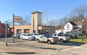
An image of Flat Rock
More city maps of Michigan:
- Map of Lansing
Lansing is the capital city of Michigan with population of around 114 thousand people. It was foun... - Map of Canton
Canton Township is located on the western outskirts of Detroit. Its population exceeds 95 thousand... - Map of Shelby
Shelby Charter Township is a CDP in Macomb County. This northern suburb of Detroit is growing fast... - Map of Rochester Hills
Rochester Hills, Michigan is a remarkable city located in Oakland County, 28 miles north to Detroi... - Map of Dearborn Heights
Dearborn Heights, Michigan is a nice suburban city of Detroit situated in Wayne County. Dearborn H... - Map of Kentwood
Kentwood, Michigan is a wonderful suburban city of Grand Rapids situated in Kent County. Kentwood ... - Map of East Lansing
East Lansing, Michigan is a remarkable suburban city of Lansing located mostly in Ingham County. T... - Map of Georgetown Township
Georgetown Township, Michigan is a remarkable township located in Ottawa County. Georgetown Townsh... - Map of Saginaw
Saginaw, Michigan is a nice city and the county seat of Saginaw County. It stands 103 miles northw... - Map of Lincoln Park
Lincoln Park, Michigan is a suburban city of Detroit, found in Wayne County. The population of Lin... - Map of Independence Township
Independence, Michigan is a nice township located on the northern outskirts of Detroit, in Oakland... - Map of Delta
Delta, Michigan is a charter township located in Eaton County. Delta is home to 33 thousand reside... - Map of White Lake
White Lake, Michigan is a charter township located in Oakland County. White Lake is home to 31 tho... - Map of Burton
Burton, Michigan is a stylish city located about 71 miles northwest of Detroit, in Genesee County.... - Map of Allen Park
Allen Park, Michigan (incorporated in 1957) is an industrial city found in Wayne County, 12 miles ... - Map of Garden City
Garden City, Michigan is a wonderful city situated in Wayne County, 13 miles west of downtown Detr... - Map of Romulus
Romulus, Michigan is a stylish city found in Wayne County, about 23 miles southwest of Detroit. Th...
Full list of Michigan maps
This online map of Flat Rock, Michigan is provided by Bing Maps. Please add a bookmark and share the page with your friends!