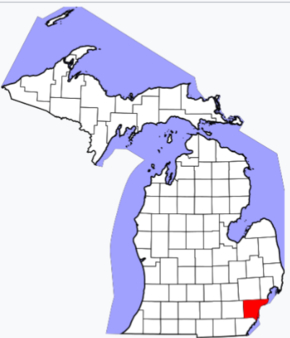
Wayne County on the map of Michigan 2026. Cities, roads, borders and directions in Wayne County of Michigan.
USA / Michigan / Wayne CountyWayne County is the most populous county in the state of Michigan. The county seat is the famous city of Detroit, and the total population of Wayne County is about 1.8 million people. This map shows the borders of Wayne County as well as neighboring counties, including major highways and natural objecsts as of 2026. Zoom in or out of the map using the plus/minus panel. Move the center of this map by dragging it. Also check out the satellite map of Wayne County.
The borders of Wayne County over the map of Michigan
Explore some more counties of Michigan:
- Wexford County
- Washtenaw County
- Van Buren County
- Tuscola County
- Shiawassee County
- Schoolcraft County
- Sanilac County
- St. Joseph County
- St. Clair County
- Saginaw County
- Roscommon County
- Presque Isle County
- Ottawa County
- Otsego County
- Oscoda County
- Osceola County
- Ontonagon County
- Ogemaw County
- Oceana County
- Newaygo County
Full list of Michigan maps
This online map of Wayne County, Michigan is provided by Bing Maps. Please add a bookmark and share the page with your friends!
© 2026 City maps and famous places