Manistee County on the map of Michigan 2026. Cities, roads, borders and directions in Manistee County of Michigan.
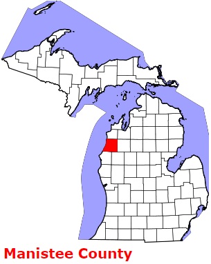
USA / Michigan / Manistee CountyManistee County is located on the coasts of Lake Michigan in the western section of Michigan. The county seat of Manistee County is Manistee. The total area of the county is about 1,281 square miles. Set up in 1840 from part of Mackinac County, today Manistee County counts over 25 thousand inhabitants. The county is named after the Manistee River, which in turn is from the Ojibwe name, ministigweyaa meaning (river) at whose mouth there are islands. This map shows the borders of Manistee County as well as neighboring counties, including major highways and natural objecsts as of 2026. Zoom in or out of the map using the plus/minus panel. Move the center of this map by dragging it. Also check out the satellite map of Manistee County.
The borders of Manistee County over the map of Michigan
Explore some more counties of Michigan:
- Wexford County
- Washtenaw County
- Van Buren County
- Tuscola County
- Shiawassee County
- Schoolcraft County
- Sanilac County
- St. Joseph County
- St. Clair County
- Saginaw County
- Roscommon County
- Presque Isle County
- Ottawa County
- Otsego County
- Oscoda County
- Osceola County
- Ontonagon County
- Ogemaw County
- Oceana County
- Newaygo County
Full list of Michigan maps
This online map of Manistee County, Michigan is provided by Bing Maps. Please add a bookmark and share the page with your friends!
© 2026 City maps and famous places