The exact coordinates of New Ulm Minnesota for your GPS track:
Latitude 44.313316 North, Longitude 94.459038 West.
Please share the link with friends and neighbors:
Share on Facebook
Share on WhatsApp
Share on Telegram
Share on Facebook
Share on WhatsApp
Share on Telegram
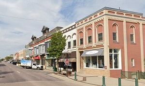
An image of New Ulm
More city maps of Minnesota:
- Map of Duluth
Duluth, incorporated in 1857, is the fourth largest city in Minnesota in terms of population, tota... - Map of Brooklyn Park
Brooklyn Park is a city located about 10 miles north to downtown Minneapolis. Its population is we... - Map of Eagan
Eagan, Minnesota is a city located in Dakota County, on the southern outskirts of Minneapolis. The... - Map of Blaine
Blaine, Minnesota is a large northern suburb of Minneapolis, incorporated as a city in 1954. The t... - Map of Apple Valley
Apple Valley, Minnesota is a wonderful city located about 20 miles south to downtown Minneapolis, ... - Map of Moorhead
The city of Moorhead, Minnesota is the county seat of Clay County. Today Moorhead is populated by ... - Map of Roseville
Roseville, Minnesota is a wonderful suburban city of Minneapolis, situated in Ramsey County. Incor... - Map of Shoreview
Shoreview, Minnesota (incorporated in 1957) is a charming city found 12 miles northeast of downtow... - Map of Chanhassen
Chanhassen, Minnesota is a shining suburban city of Minneapolis located in Carver County. Chanhass... - Map of Champlin
Champlin, Minnesota is a hilarious city situated 20 miles north of Minneapolis, in Hennepin County... - Map of Columbia Heights
Columbia Heights, Minnesota is a wonderful city situated in Anoka County. Today Columbia Heights i... - Map of West St. Paul
West St. Paul, Minnesota is a wonderful city situated in Dakota County. Today West St. Paul is pop... - Map of Stillwater
Stillwater, Minnesota is a shining city located in Washington County. It stands on the banks of th... - Map of Anoka
Anoka is the county seat of Anoka County, Minnesota. The city is situated along the Rum River, app... - Map of Ham Lake
Ham Lake is a city located in Anoka County, Minnesota. It is a suburb of the Twin Cities metropoli... - Map of Robbinsdale
Robbinsdale, Minnesota is an adorable city located in Hennepin County. It stands in the eastern pa... - Map of Marshall
Marshall is a city located in Lyon County, Minnesota. It stands in the southwestern part of the st...
Full list of Minnesota maps
This online map of New Ulm, Minnesota is provided by Bing Maps. Please add a bookmark and share the page with your friends!