The exact coordinates of Waconia Minnesota for your GPS track:
Latitude 44.850468 North, Longitude 93.785812 West.
Please share the link with friends and neighbors:
Share on Facebook
Share on WhatsApp
Share on Telegram
Share on Facebook
Share on WhatsApp
Share on Telegram
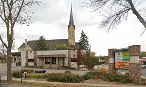
An image of Waconia
More city maps of Minnesota:
- Map of Rochester
Rochester (founded 1854) is the third largest city in Minnesota and a county seat of Olmsted Count... - Map of Brooklyn Center
Brooklyn Center, incorporated 1966, is a city in Hennepin County, Minnesota. It is actually just a... - Map of St. Cloud
St. Cloud, Minnesota, known as "The Granite City" is located in the central part of the state, som... - Map of Eden Prairie
Eden Prairie, Minnesota is a cool suburban city situated in Hennepin County. Today Eden Prairie is... - Map of Mankato
Mankato, Minnesota is a stylish city found about 80 miles southwest to Minneapolis. The population... - Map of Richfield
Richfield, Minnesota (incorporated in 1908) is a suburban city of Minneapolis, standing in Hennepi... - Map of Savage
Savage, Minnesota is a nice suburban city of Minneapolis, located in Scott County. Incorporated ba... - Map of Oakdale
Oakdale, Minnesota is an attractive city located near Saint Paul in Washington County. Organized i... - Map of Elk River
Elk River, Minnesota is an attractive city located in Sherburne County, about 30 miles northwest o... - Map of Farmington
Farmington, Minnesota is a wonderful city standing 30 miles south of Minneapolis, in Dakota County... - Map of Hastings
Hastings, Minnesota is a dynamic city and the seat of Dakota County. The population of Hastings ex... - Map of Willmar
Willmar, Minnesota is a dynamic city and the county seat of Kandiyohi County. The population of Wi... - Map of St. Michael
St. Michael, Minnesota is a charming city located in Wright County. It stands about 35 miles north... - Map of Red Wing
Red Wing, Minnesota is a shining city located in Goodhue County. It stands in the southeastern par... - Map of Bemidji
Bemidji, Minnesota is a city located in Beltrami County. It stands in the northern part of the sta... - Map of Brainerd
Brainerd, Minnesota is a wonderful city found in Crow Wing County. It stands in the central part o... - Map of Worthington
Worthington is a city located in Nobles County, Minnesota. It stands in the southwestern part of t...
Distances from Waconia, Minnesota:
- Distance between Waconia and Rochester
- Distance between Waconia and Brooklyn Center
- Distance between Waconia and St. Cloud
- Distance between Waconia and Eden Prairie
- Distance between Waconia and Mankato
- Distance between Waconia and Richfield
- Distance between Waconia and Savage
- Distance between Waconia and Oakdale
- Distance between Waconia and Elk River
- Distance between Waconia and Farmington
- Distance between Waconia and Hastings
- Distance between Waconia and Willmar
- Distance between Waconia and St. Michael
- Distance between Waconia and Red Wing
- Distance between Waconia and Bemidji
- Distance between Waconia and Brainerd
- Distance between Waconia and Worthington
Full list of Minnesota maps
This online map of Waconia, Minnesota is provided by Bing Maps. Please add a bookmark and share the page with your friends!