Union County on the map of Mississippi 2026. Cities, roads, borders and directions in Union County of Mississippi.
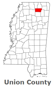
USA / Mississippi / Union CountyUnion County is situated in the northern lands of Mississippi. This particular county is named after Reunion of Confederacy with the United States. The total area of Union County is about 416 square miles. This county, set up in 1870, is populated today by at least 28 thousand residents. New Albany is the county seat of Union County. This map shows the borders of Union County as well as neighboring counties, including major highways and natural objecsts as of 2026. Zoom in or out of the map using the plus/minus panel. Move the center of this map by dragging it. Also check out the satellite map of Union County.
The borders of Union County over the map of Mississippi
Explore some more counties of Mississippi:
- Yazoo County
- Yalobusha County
- Winston County
- Wilkinson County
- Webster County
- Wayne County
- Washington County
- Warren County
- Walthall County
- Tunica County
- Tishomingo County
- Tippah County
- Tate County
- Tallahatchie County
- Sunflower County
- Stone County
- Smith County
- Simpson County
- Sharkey County
- Scott County
Full list of Mississippi maps
This online map of Union County, Mississippi is provided by Bing Maps. Please add a bookmark and share the page with your friends!
© 2026 City maps and famous places