Holt County on the map of Nebraska 2025. Cities, roads, borders and directions in Holt County of Nebraska.
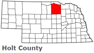
USA / Nebraska / Holt CountyHolt County is found in the northern region of Nebraska. This nice county is named after Joseph Holt, U.S. Postmaster General and Secretary of War. The overall population of Holt County reaches 10 thousand people. The county, formed in 1860, covers an area of 2413 square miles. The county seat of Holt County is O'Neill. This map shows the borders of Holt County as well as neighboring counties, including major highways and natural objecsts as of 2025. Zoom in or out of the map using the plus/minus panel. Move the center of this map by dragging it. Also check out the satellite map of Holt County.
The borders of Holt County over the map of Nebraska
Explore some more counties of Nebraska:
- York County
- Wheeler County
- Webster County
- Wayne County
- Washington County
- Valley County
- Thurston County
- Thomas County
- Thayer County
- Stanton County
- Sioux County
- Sherman County
- Sheridan County
- Seward County
- Scotts Bluff County
- Saunders County
- Sarpy County
- Saline County
- Rock County
- Richardson County
Full list of Nebraska maps
This online map of Holt County, Nebraska is provided by Bing Maps. Please add a bookmark and share the page with your friends!
© 2025 City maps and famous places