Lancaster County on the map of Nebraska 2026. Cities, roads, borders and directions in Lancaster County of Nebraska.
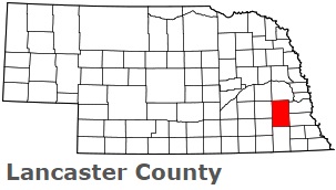
USA / Nebraska / Lancaster CountyLancaster County is situated in the eastern region of Nebraska. This particular county is named after Lancaster, Pennsylvania and Lancaster, England. The total area of Lancaster County is about 839 square miles. This county, set up in 1855, is populated today by at least 325 thousand residents. Lincoln is the county seat of Lancaster County. This map shows the borders of Lancaster County as well as neighboring counties, including major highways and natural objecsts as of 2026. Zoom in or out of the map using the plus/minus panel. Move the center of this map by dragging it. Also check out the satellite map of Lancaster County.
The borders of Lancaster County over the map of Nebraska
Explore some more counties of Nebraska:
- York County
- Wheeler County
- Webster County
- Wayne County
- Washington County
- Valley County
- Thurston County
- Thomas County
- Thayer County
- Stanton County
- Sioux County
- Sherman County
- Sheridan County
- Seward County
- Scotts Bluff County
- Saunders County
- Sarpy County
- Saline County
- Rock County
- Richardson County
Full list of Nebraska maps
This online map of Lancaster County, Nebraska is provided by Bing Maps. Please add a bookmark and share the page with your friends!
© 2026 City maps and famous places