The exact coordinates of Cliffside Park New Jersey for your GPS track:
Latitude 40.821995 North, Longitude 73.986641 West.
Please share the link with friends and neighbors:
Share on Facebook
Share on WhatsApp
Share on Telegram
Share on Facebook
Share on WhatsApp
Share on Telegram
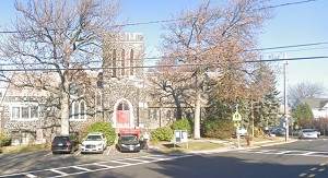
An image of Cliffside Park
More city maps of New Jersey:
- Map of Jersey City
Jersey City is the second largest city in New Jersey with population of about 248 thousand. It's l... - Map of Woodbridge
Woodbridge Township is located in New Jersey, to the west of Staten Island. Its population counts ... - Map of Camden
Camden, New Jersey, is located to the east of Philadelphia city, across the Delaware River. The po... - Map of Princeton
Princeton, New Jersey is a city with borough-type administration, populated by 30 thousand residen... - Map of Old Bridge
Old Bridge, New Jersey is an excellent township located in Middlesex County, about 40 miles south ... - Map of North Bergen
North Bergen, New Jersey is a nice township situated in Hudson County, on the opposite bank to Man... - Map of Parsippany
Parsippany–Troy Hills, New Jersey is a remarkable township located in Morris County. Parsippanyâ... - Map of Howell
Howell, New Jersey is a nice township situated about 60 miles south to NYC, in Monmouth County. Ho... - Map of Washington Township, Gloucester County
Washington Township is located in Gloucester County, New Jersey, about 18 miles south of Philadelp... - Map of South Brunswick Township
South Brunswick, New Jersey is a wonderful township located in Middlesex County. The township was ... - Map of Mount Laurel Township
Mount Laurel is a township located in Burlington County, New Jersey. Mt Laurel was originally sett... - Map of Kearny
Kearny, New Jersey is a charming town located in Hudson County. Kearny was originally settled in t... - Map of Winslow
Winslow, New Jersey is a township located in Camden County. Winslow was originally settled in the ... - Map of Egg Harbor Township
Egg Harbor Township, New Jersey is located in Atlantic County. The township was first mentioned as... - Map of Fair Lawn
Fair Lawn is a borough located in Bergen County, New Jersey. It covers an area of 5.2 square miles... - Map of Long Branch
Long Branch is a coastal city in Monmouth County, New Jersey. It is located approximately 50 miles... - Map of East Windsor
East Windsor is a township in Mercer County, New Jersey. It is located approximately 12 miles east...
Full list of New Jersey maps
This online map of Cliffside Park, New Jersey is provided by Bing Maps. Please add a bookmark and share the page with your friends!