The exact coordinates of Hillsborough Township New Jersey for your GPS track:
Latitude 40.503906 North, Longitude 74.67205 West.
Please share the link with friends and neighbors:
Share on Facebook
Share on WhatsApp
Share on Telegram
Share on Facebook
Share on WhatsApp
Share on Telegram
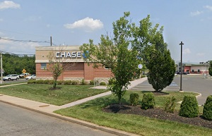
An image of Hillsborough Township
More city maps of New Jersey:
- Map of Newark
Newark is a city located in northeastern New Jersey, and the largest city in the state, with a pop... - Map of Edison
Edison, New Jersey is a mid-size township on the left bank of Raritan River with a population of a... - Map of Clifton
Clifton, New Jersey is located in Passaic County and has a population of over 84 thousand pepole.... - Map of Bayonne
Bayonne, New Jersey is a coastal city located just about 9 miles southwest to Manhattan, NYC. Bayo... - Map of Franklin Township, Somerset County
Franklin Township, New Jersey is a beautiful township situated in Somerset County, about 45 miles ... - Map of Piscataway
Piscataway, New Jersey is a cool township located in Middlesex County, about 35 miles southwest to... - Map of Wayne
Wayne, New Jersey is a large township located in Passaic County. The total population of Wayne exc... - Map of Evesham Township
Evesham, New Jersey is a township located in Burlington County. Evesham was originally settled by ... - Map of Manchester Township
Manchester, New Jersey is an adorable township located in Ocean County. Manchester Township was or... - Map of Montclair
Montclair, New Jersey is a shining township located in Essex County. Montclair was originally sett... - Map of Galloway Township
Galloway, New Jersey is a township located in Atlantic County. Galloway was originally settled in ... - Map of Freehold Township
Freehold Township is located in Monmouth County, New Jersey. Freehold Township covers an area of 3... - Map of Willingboro
Willingboro, New Jersey is a lovely township located in Burlington County. It stands 20 miles east... - Map of Nutley
Nutley is a township in Essex County, New Jersey. It is located approximately 10 miles west of New... - Map of Mount Olive
Mount Olive, New Jersey is an adorable township in Morris County. It is located approximately 40 m... - Map of Lawrence Township
Lawrence Township is a municipality in Mercer County, New Jersey. Lawrence Township is located in ... - Map of Bridgeton
Bridgeton is a city located in Cumberland County, New Jersey. It stands in the southern part of Ne...
Full list of New Jersey maps
This online map of Hillsborough Township, New Jersey is provided by Bing Maps. Please add a bookmark and share the page with your friends!