The exact coordinates of Freehold Township New Jersey for your GPS track:
Latitude 40.2276 North, Longitude 74.291992 West.
Please share the link with friends and neighbors:
Share on Facebook
Share on WhatsApp
Share on Telegram
Share on Facebook
Share on WhatsApp
Share on Telegram
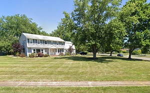
An image of Freehold Township
More city maps of New Jersey:
- Map of Newark
Newark is a city located in northeastern New Jersey, and the largest city in the state, with a pop... - Map of Edison
Edison, New Jersey is a mid-size township on the left bank of Raritan River with a population of a... - Map of Clifton
Clifton, New Jersey is located in Passaic County and has a population of over 84 thousand pepole.... - Map of Bayonne
Bayonne, New Jersey is a coastal city located just about 9 miles southwest to Manhattan, NYC. Bayo... - Map of Franklin Township, Somerset County
Franklin Township, New Jersey is a beautiful township situated in Somerset County, about 45 miles ... - Map of Piscataway
Piscataway, New Jersey is a cool township located in Middlesex County, about 35 miles southwest to... - Map of Wayne
Wayne, New Jersey is a large township located in Passaic County. The total population of Wayne exc... - Map of Evesham Township
Evesham, New Jersey is a township located in Burlington County. The population of Evesham Township... - Map of Manchester Township
Manchester, New Jersey is an adorable township located in Ocean County. Today Manchester Township,... - Map of Hillsborough Township
Hillsborough, New Jersey is a lovely township located in Somerset County. Today Hillsborough is po... - Map of Montclair
Montclair, New Jersey is a shining township located in Essex County. The population of Montclair e... - Map of Galloway Township
Galloway, New Jersey is a township located in Atlantic County. Today Galloway is home to 38 thousa... - Map of Willingboro
Willingboro Township, New Jersey is located in Burlington County. The population of Willingboro To... - Map of Nutley
Nutley is a township in Essex County, New Jersey. It is located approximately 10 miles west of New... - Map of Mount Olive
Mount Olive, New Jersey is an adorable township in Morris County. Mount Olive Township is home t... - Map of Lawrence Township
Lawrence Township is a municipality in Mercer County, New Jersey. Today Lawrence Township is home ... - Map of Bridgeton
Bridgeton is a city located in Cumberland County, New Jersey. Today Bridgeton is populated by 27 t...
This online map of Freehold Township, New Jersey is provided by Bing Maps. Please add a bookmark and share the page with your friends!