The exact coordinates of Scotch Plains New Jersey for your GPS track:
Latitude 40.640053 North, Longitude 74.368607 West.
Please share the link with friends and neighbors:
Share on Facebook
Share on WhatsApp
Share on Telegram
Share on Facebook
Share on WhatsApp
Share on Telegram
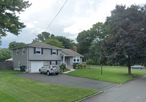
An image of Scotch Plains
More city maps of New Jersey:
- Map of Jersey City
Jersey City is the second largest city in New Jersey with population of about 248 thousand. It's l... - Map of Woodbridge
Woodbridge Township is located in New Jersey, to the west of Staten Island. Its population counts ... - Map of Camden
Camden, New Jersey, is located to the east of Philadelphia city, across the Delaware River. The po... - Map of Princeton
Princeton, New Jersey is a city with borough-type administration, populated by 30 thousand residen... - Map of Old Bridge
Old Bridge, New Jersey is an excellent township located in Middlesex County, about 40 miles south ... - Map of North Bergen
North Bergen, New Jersey is a nice township situated in Hudson County, on the opposite bank to Man... - Map of Parsippany
Parsippany–Troy Hills, New Jersey is a remarkable township located in Morris County. Parsippany�... - Map of Howell
Howell, New Jersey is a nice township situated about 60 miles south to NYC, in Monmouth County. Ho... - Map of Washington Township, Gloucester County
Washington Township is located in Gloucester County, New Jersey, about 18 miles south of Philadelp... - Map of South Brunswick Township
South Brunswick, New Jersey is a wonderful township located in Middlesex County. The township was ... - Map of Mount Laurel Township
Mount Laurel is a township located in Burlington County, New Jersey. Mt Laurel was originally sett... - Map of Kearny
Kearny, New Jersey is a charming town located in Hudson County. Kearny was originally settled in t... - Map of Winslow
Winslow, New Jersey is a township located in Camden County. Winslow was originally settled in the ... - Map of Egg Harbor Township
Egg Harbor Township, New Jersey is located in Atlantic County. The township was first mentioned as... - Map of Fair Lawn
Fair Lawn is a borough located in Bergen County, New Jersey. It covers an area of 5.2 square miles... - Map of Long Branch
Long Branch is a coastal city in Monmouth County, New Jersey. It is located approximately 50 miles... - Map of East Windsor
East Windsor is a township in Mercer County, New Jersey. It is located approximately 12 miles east...
Distances from Scotch Plains, New Jersey:
- Distance between Scotch Plains and Jersey City
- Distance between Scotch Plains and Woodbridge
- Distance between Scotch Plains and Camden
- Distance between Scotch Plains and Princeton
- Distance between Scotch Plains and Old Bridge
- Distance between Scotch Plains and North Bergen
- Distance between Scotch Plains and Parsippany
- Distance between Scotch Plains and Howell
- Distance between Scotch Plains and Washington Township, Gloucester County
- Distance between Scotch Plains and South Brunswick Township
- Distance between Scotch Plains and Mount Laurel Township
- Distance between Scotch Plains and Kearny
- Distance between Scotch Plains and Winslow
- Distance between Scotch Plains and Egg Harbor Township
- Distance between Scotch Plains and Fair Lawn
- Distance between Scotch Plains and Long Branch
- Distance between Scotch Plains and East Windsor
Full list of New Jersey maps
This online map of Scotch Plains, New Jersey is provided by Bing Maps. Please add a bookmark and share the page with your friends!