The exact coordinates of Dayton Nevada for your GPS track:
Latitude 39.236275 North, Longitude 119.59066 West.
Please share the link with friends and neighbors:
Share on Facebook
Share on WhatsApp
Share on Telegram
Share on Facebook
Share on WhatsApp
Share on Telegram
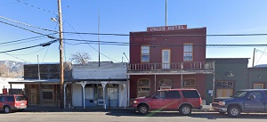
An image of Dayton
More city maps of Nevada:
- Map of Enterprise
Enterprise, Nevada is a CDP on the southern edge of Las Vegas metro area with 171 thousand inhabit... - Map of Fernley
Fernley, Nevada (incorporated 2001) is a dynamic city found in Lyon County. The population of Fern...
Full list of Nevada maps
This online map of Dayton, Nevada is provided by Bing Maps. Please add a bookmark and share the page with your friends!