Grant County on the map of Oregon 2026. Cities, roads, borders and directions in Grant County of Oregon.
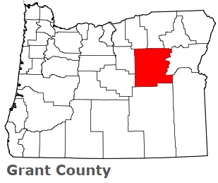
USA / Oregon / Grant CountyGrant County is a vast county located in the eastern portion of Oregon. This amazing county is named after Ulysses S. Grant (1822-1885), a President of the United States (1869-1877). The area of Grant County is about 4,529 square miles. This county, set up in 1864, is populated today by 7 thousand residents. Canyon City is the county seat of Grant County. This map shows the borders of Grant County as well as neighboring counties, including major highways and natural objecsts as of 2026. Zoom in or out of the map using the plus/minus panel. Move the center of this map by dragging it. Also check out the satellite map of Grant County.
The borders of Grant County over the map of Oregon
Explore some more counties of Oregon:
- Yamhill County
- Wheeler County
- Washington County
- Wasco County
- Wallowa County
- Union County
- Umatilla County
- Tillamook County
- Sherman County
- Polk County
- Morrow County
- Marion County
- Malheur County
- Linn County
- Lincoln County
- Lane County
- Lake County
- Klamath County
- Josephine County
- Jefferson County
Full list of Oregon maps
This online map of Grant County, Oregon is provided by Bing Maps. Please add a bookmark and share the page with your friends!
© 2026 City maps and famous places