Jackson County on the map of Oregon 2026. Cities, roads, borders and directions in Jackson County of Oregon.
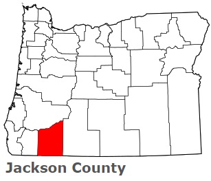
USA / Oregon / Jackson CountyJackson County is located on the southern border of Oregon. This wonderful county is named after Andrew Jackson. The area of Jackson County is about 2,785 square miles. This county, created in 1852, is populated today by 224 thousand residents. Medford is the county seat of Jackson County. This map shows the borders of Jackson County as well as neighboring counties, including major highways and natural objecsts as of 2026. Zoom in or out of the map using the plus/minus panel. Move the center of this map by dragging it. Also check out the satellite map of Jackson County.
The borders of Jackson County over the map of Oregon
Explore some more counties of Oregon:
- Yamhill County
- Wheeler County
- Washington County
- Wasco County
- Wallowa County
- Union County
- Umatilla County
- Tillamook County
- Sherman County
- Polk County
- Morrow County
- Marion County
- Malheur County
- Linn County
- Lincoln County
- Lane County
- Lake County
- Klamath County
- Josephine County
- Jefferson County
Full list of Oregon maps
This online map of Jackson County, Oregon is provided by Bing Maps. Please add a bookmark and share the page with your friends!
© 2026 City maps and famous places