Hardin County on the map of Tennessee 2025. Cities, roads, borders and directions in Hardin County of Tennessee.
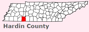
USA / Tennessee / Hardin CountyHardin County is found on the southern border of Tennessee. This amazing county is named after Joseph Hardin, legislator of the Southwest Territory and State of Franklin. The overall population of Hardin County reaches 27 thousand people. The county, organized in 1819, covers an area of 578 square miles. The county seat of Hardin County is Savannah. This map shows the borders of Hardin County as well as neighboring counties, including major highways and natural objecsts as of 2025. Zoom in or out of the map using the plus/minus panel. Move the center of this map by dragging it. Also check out the satellite map of Hardin County.
The borders of Hardin County over the map of Tennessee
Explore some more counties of Tennessee:
- Wilson County
- Williamson County
- White County
- Weakley County
- Wayne County
- Washington County
- Warren County
- Van Buren County
- Union County
- Unicoi County
- Trousdale County
- Tipton County
- Sumner County
- Sullivan County
- Stewart County
- Smith County
- Sevier County
- Sequatchie County
- Scott County
- Rutherford County
Full list of Tennessee maps
This online map of Hardin County, Tennessee is provided by Bing Maps. Please add a bookmark and share the page with your friends!
© 2025 City maps and famous places