Jefferson County on the map of Wisconsin 2026. Cities, roads, borders and directions in Jefferson County of Wisconsin.
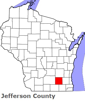
USA / Wisconsin / Jefferson CountyJefferson County is found in the southern region of Wisconsin. This fantastic county is named after Thomas Jefferson (1743-1826), President of the United States (1801-09). The population of Jefferson County exceeds 85 thousand people. The county, formed in 1836, spans an area of 556 square miles. The county seat of Jefferson County is Jefferson. This map shows the borders of Jefferson County as well as neighboring counties, including major highways and natural objecsts as of 2026. Zoom in or out of the map using the plus/minus panel. Move the center of this map by dragging it. Also check out the satellite map of Jefferson County.
The borders of Jefferson County over the map of Wisconsin
Explore some more counties of Wisconsin:
- Wood County
- Winnebago County
- Waushara County
- Waupaca County
- Waukesha County
- Washington County
- Washburn County
- Walworth County
- Vilas County
- Vernon County
- Trempealeau County
- Taylor County
- St. Croix County
- Sheboygan County
- Shawano County
- Sawyer County
- Sauk County
- Rusk County
- Rock County
- Richland County
Full list of Wisconsin maps
This online map of Jefferson County, Wisconsin is provided by Bing Maps. Please add a bookmark and share the page with your friends!
© 2026 City maps and famous places