Carbon County on the map of Wyoming 2026. Cities, roads, borders and directions in Carbon County of Wyoming.
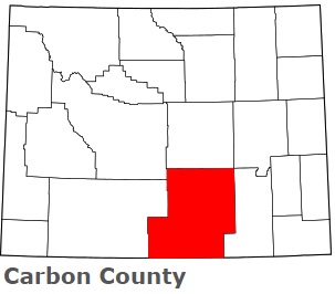
USA / Wyoming / Carbon CountyCarbon County is located on the southern border of Wyoming. This interesting county is named after the vast coal beds in the county. The county seat of Carbon County is Rawlins. The county's area is about 7,897 square miles. Founded in 1868, today Carbon County is home to 15 thousand residents. This map shows the borders of Carbon County as well as neighboring counties, including major highways and natural objecsts as of 2026. Zoom in or out of the map using the plus/minus panel. Move the center of this map by dragging it. Also check out the satellite map of Carbon County.
The borders of Carbon County over the map of Wyoming
Explore some more counties of Wyoming:
- Weston County
- Washakie County
- Uinta County
- Teton County
- Sweetwater County
- Sublette County
- Sheridan County
- Platte County
- Park County
- Niobrara County
- Natrona County
- Lincoln County
- Laramie County
- Johnson County
- Hot Springs County
- Goshen County
- Fremont County
- Crook County
- Converse County
- Campbell County
Full list of Wyoming maps
This online map of Carbon County, Wyoming is provided by Bing Maps. Please add a bookmark and share the page with your friends!
© 2026 City maps and famous places