Please share the link with friends and neighbors:
Share on Facebook
Share on WhatsApp
Share on Telegram
Share on Facebook
Share on WhatsApp
Share on Telegram
Benin is listed in:
Cool facts and FAQ about Benin:
What and where is the country of Benin?What is the history of Benin and how did it get its name?
What are the main cultural traditions and religions in Benin?
What are the key attractions and places to visit in Benin?
What is the economy of Benin like?
Is Benin safe for visitors and what should travelers know?
What languages are spoken in Benin and what is the population like?
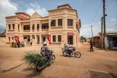
Image of Benin:
Check out some more famous and interesting places on our planet:
- Sri Lanka
- Macao
- Ukraine
- Guinea-Bissau
- New Caledonia
- Guinea
- Ghana
- Georgia
- Gabon
- Ethiopia
- Djibouti
- Côte d'Ivoire
- Cuba
- Colombia
- Aruba
- Chad
- Cameroon
- Botswana
- Bosnia and Herzegovina
- Guadeloupe
This online map of Benin is provided by OpenStreetMap.
Please add a bookmark and share the page with your friends!