Please share the link with friends and neighbors:
Share on Facebook
Share on WhatsApp
Share on Telegram
Share on Facebook
Share on WhatsApp
Share on Telegram
Colombia is listed in:
Cool facts and FAQ about Colombia:
What are the must-see places to visit in Colombia?Is Colombia safe to travel to right now?
What should I try to eat and drink in Colombia?
How do Colombians live day-to-day — what’s the lifestyle like?
How easy is it to get around Colombia — flights, buses, and trains?
What cultural etiquette should visitors know before going to Colombia?
What is Colombia’s history in a nutshell and why does it matter today?
What are Colombia’s major festivals and when should I time a trip?
How much does it cost to live in Colombia and can expats live comfortably?
What music, dance, and arts should I check out while in Colombia?
Cool facts about Colombia
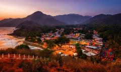
Image of Colombia:
Check out some more famous and interesting places on our planet:
- Sri Lanka
- Macao
- Ukraine
- Guinea-Bissau
- New Caledonia
- Guinea
- Ghana
- Georgia
- Gabon
- Ethiopia
- Djibouti
- Côte d'Ivoire
- Cuba
- Aruba
- Chad
- Cameroon
- Botswana
- Bosnia and Herzegovina
- Benin
- Guadeloupe
This online map of Colombia is provided by OpenStreetMap.
Please add a bookmark and share the page with your friends!