Please share the link with friends and neighbors:
Share on Facebook
Share on WhatsApp
Share on Telegram
Share on Facebook
Share on WhatsApp
Share on Telegram
Chechnya is listed in:
Cool facts and FAQ about Chechnya:
What is the population of Chechnya?What is the capital of Chechnya?
What language is spoken in Chechnya?
What is the history of Chechnya?
What is the economy of Chechnya based on?
What are popular attractions in Chechnya?
What culture is Chechnya known for?
Cool facts about Chechnya
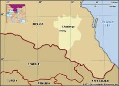
Image of Chechnya:
Check out some more famous and interesting places on our planet:
- Bougainville
- New Brunswick
- Manitoba
- Alberta
- British Columbia
- Nova Scotia
- Ontario
- Grand Faw Port
- Hampshire
- Gloucestershire
- Essex
- East Sussex
- East Yorkshire
- Durham
- Dorset
- Devon
- Derbyshire
- Cumbria
- Cornwall
- Cheshire
This online map of Chechnya is provided by OpenStreetMap.
Please add a bookmark and share the page with your friends!