Please share the link with friends and neighbors:
Share on Facebook
Share on WhatsApp
Share on Telegram
Share on Facebook
Share on WhatsApp
Share on Telegram
Monte-Carlo is listed in:
Cool facts and FAQ about Monte-Carlo:
Where exactly is Monte-Carlo?Is Monte-Carlo the capital of Monaco?
Why is Monte-Carlo so popular?
Can you visit Monte-Carlo on a budget?
What’s the best time to go to Monte-Carlo?
Do you need a passport to visit Monte-Carlo?
What can you do in Monte-Carlo besides gambling?
Is Monte-Carlo safe for tourists?
How do you get to Monte-Carlo?
Cool facts about Monte-Carlo
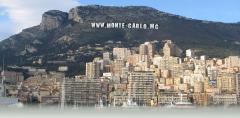
Image of Monte-Carlo:
Check out some more famous and interesting places on our planet:
- Bougainville
- New Brunswick
- Manitoba
- Alberta
- British Columbia
- Nova Scotia
- Ontario
- Grand Faw Port
- Hampshire
- Gloucestershire
- Essex
- East Sussex
- East Yorkshire
- Durham
- Dorset
- Devon
- Derbyshire
- Cumbria
- Cornwall
- Cheshire
This online map of Monte-Carlo is provided by OpenStreetMap.
Please add a bookmark and share the page with your friends!