Apache County on the map of Arizona 2026. Cities, roads, borders and directions in Apache County of Arizona.
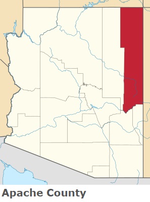
USA / Arizona / Apache CountyApache County is stretched along the eastern border of Arizona. This remarkable county was named after the Apache (Ndee) people. The county seat of Apache County is St. Johns. The county's area is 11,218 square miles. Established in 1879, today Apache County is home to 66 thousand Americans. This map shows the borders of Apache County as well as neighboring counties, including major highways and natural objecsts as of 2026. Zoom in or out of the map using the plus/minus panel. Move the center of this map by dragging it. Also check out the satellite map of Apache County.
The borders of Apache County over the map of Arizona
Explore some more counties of Arizona:
- Yuma County
- Yavapai County
- Santa Cruz County
- Pinal County
- Navajo County
- Mohave County
- La Paz County
- Greenlee County
- Graham County
- Gila County
- Coconino County
- Cochise County
- Pima County
- Maricopa County
Full list of Arizona maps
This online map of Apache County, Arizona is provided by Bing Maps. Please add a bookmark and share the page with your friends!
© 2026 City maps and famous places